Switzerland 2023
TROCKENERSTEG KLEIN MATTERHORN / GLACIER TRAIL
DAY 5 : FRIDAY JULY 07, 2023
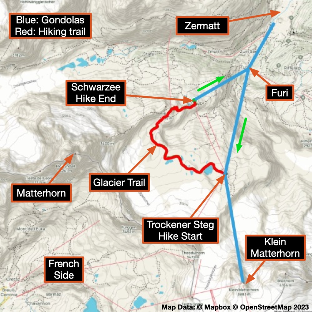
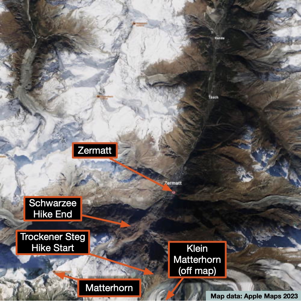
Key Hike Data
- Matterhorm peak: 4,478 m / 14,692 ft
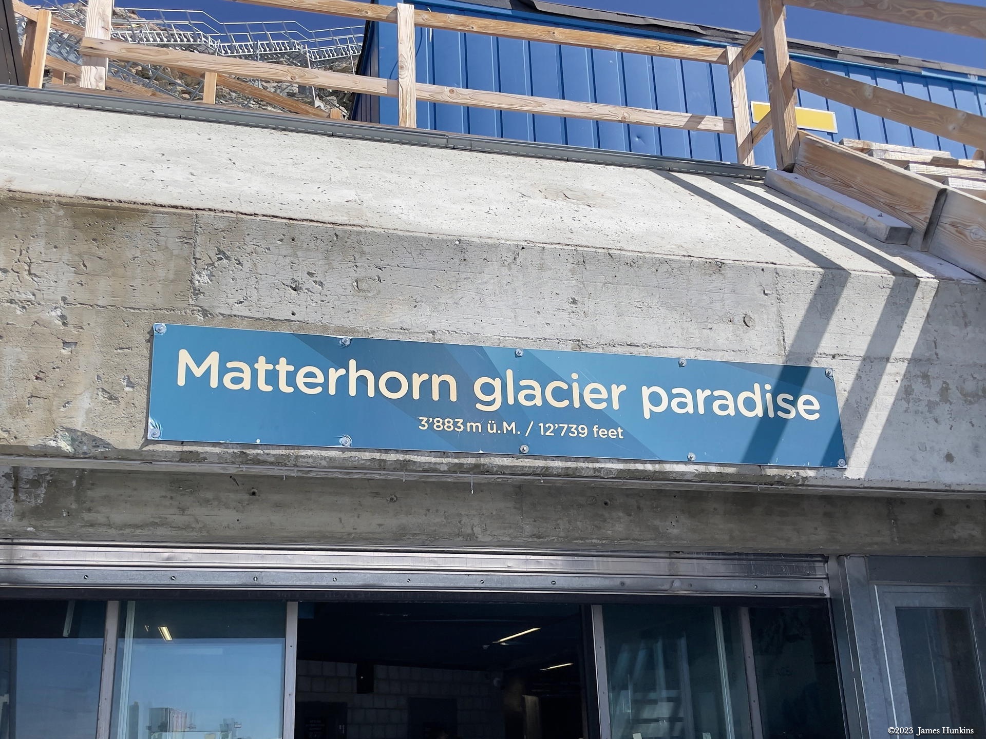
- Highest point - Klein Matterhorn: 3,883 m / 12,739 ft
- Start - Trockener Steg:2,910 m / 9,543 ft
- End - Schwarzee: 2,535 m / 8,318 ft
Restaurants
- Lunch: Restaurant Trockener Steg
- Dinner: Information to be added
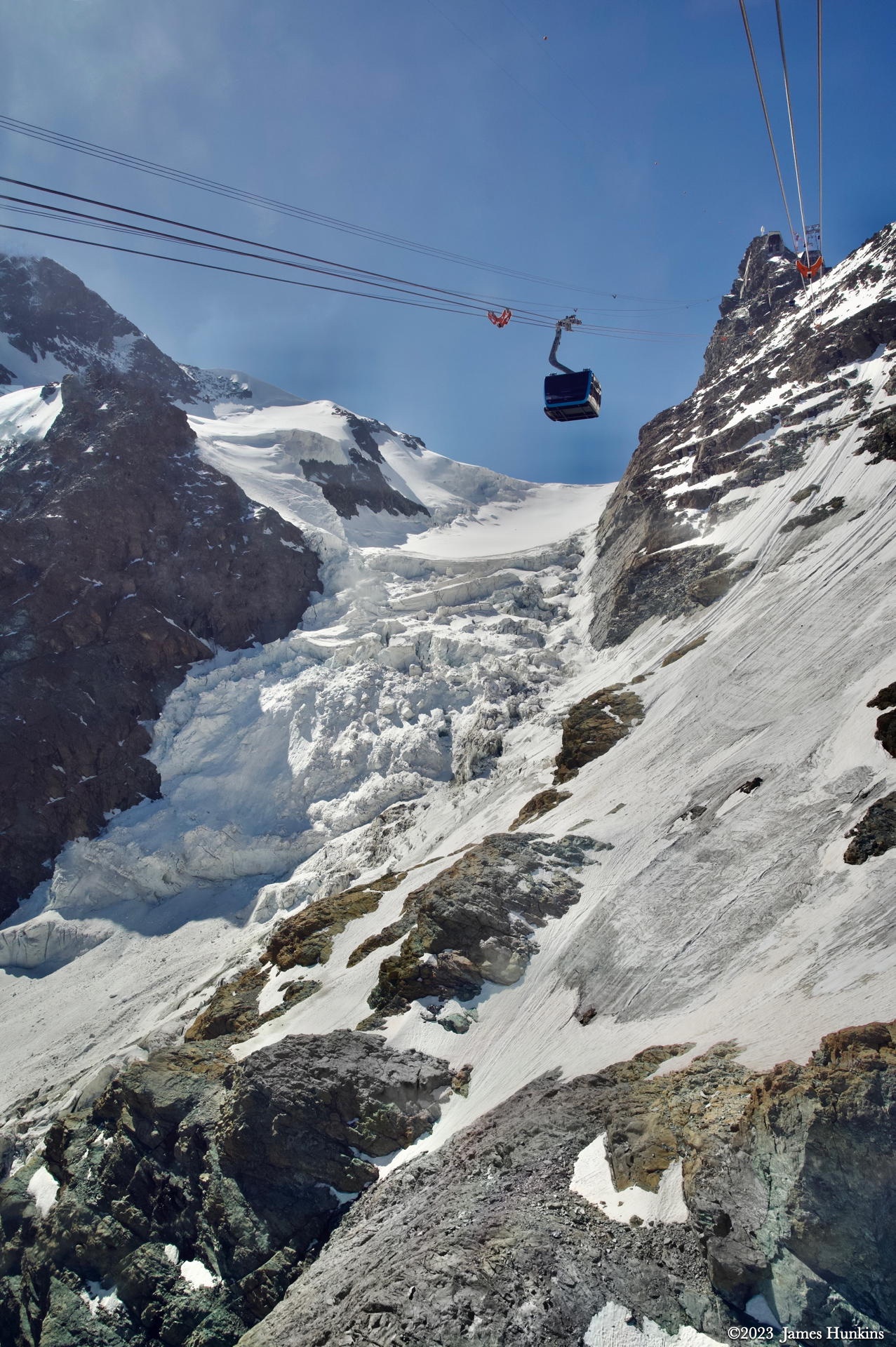
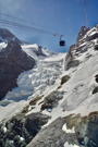
Today is the day that we head as far up in altitude that we can go short of climbing the Matterhorn itself. As usual, in Zermatt, this means hopping onto a combination of gondolas. Our route started going up over trees heading towards Furi station. Then switching gondolas, it continued over a ridge and very rugged terrain before arriving at Trockener Steg station where we ate an easy lunch.
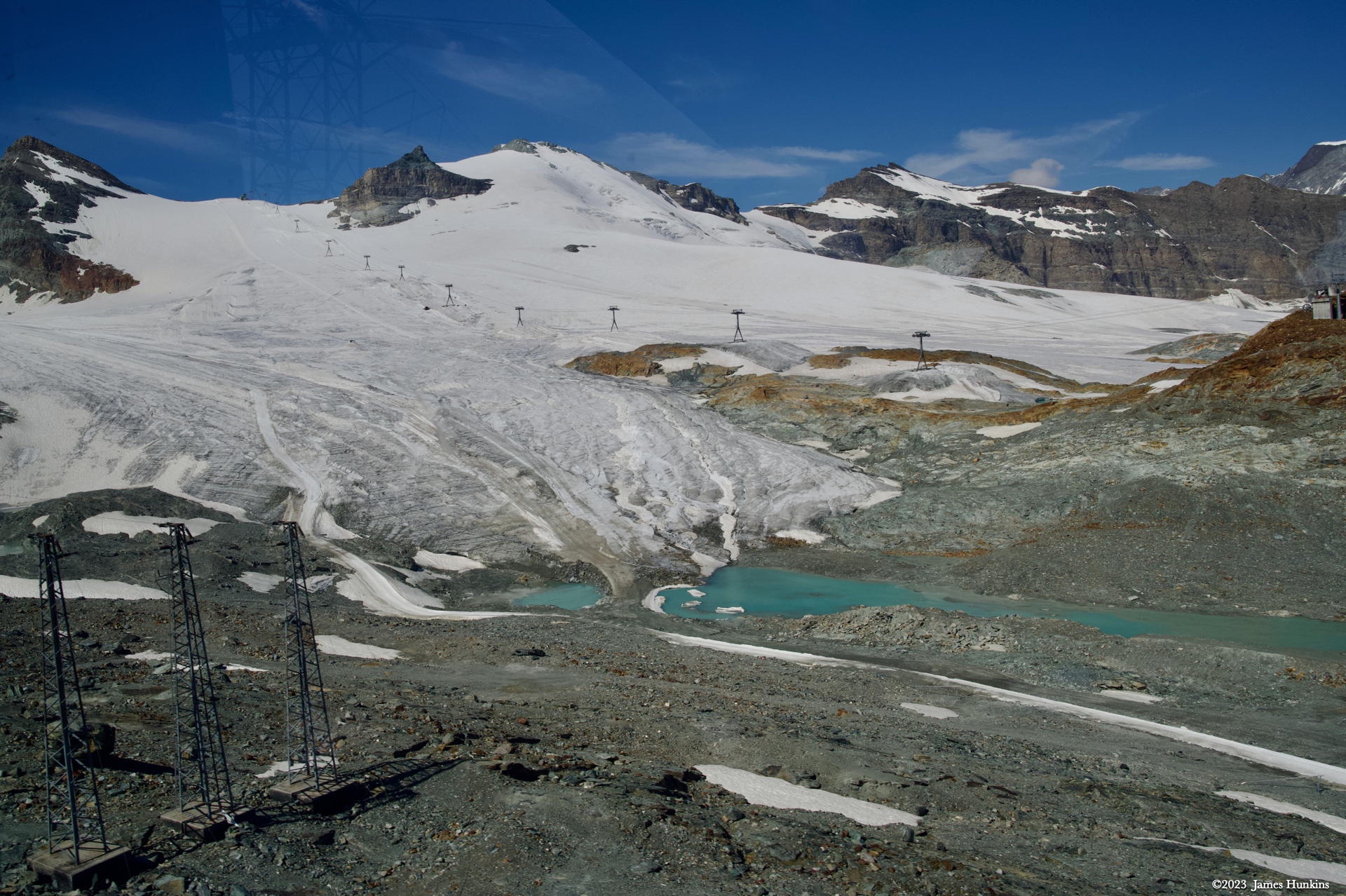
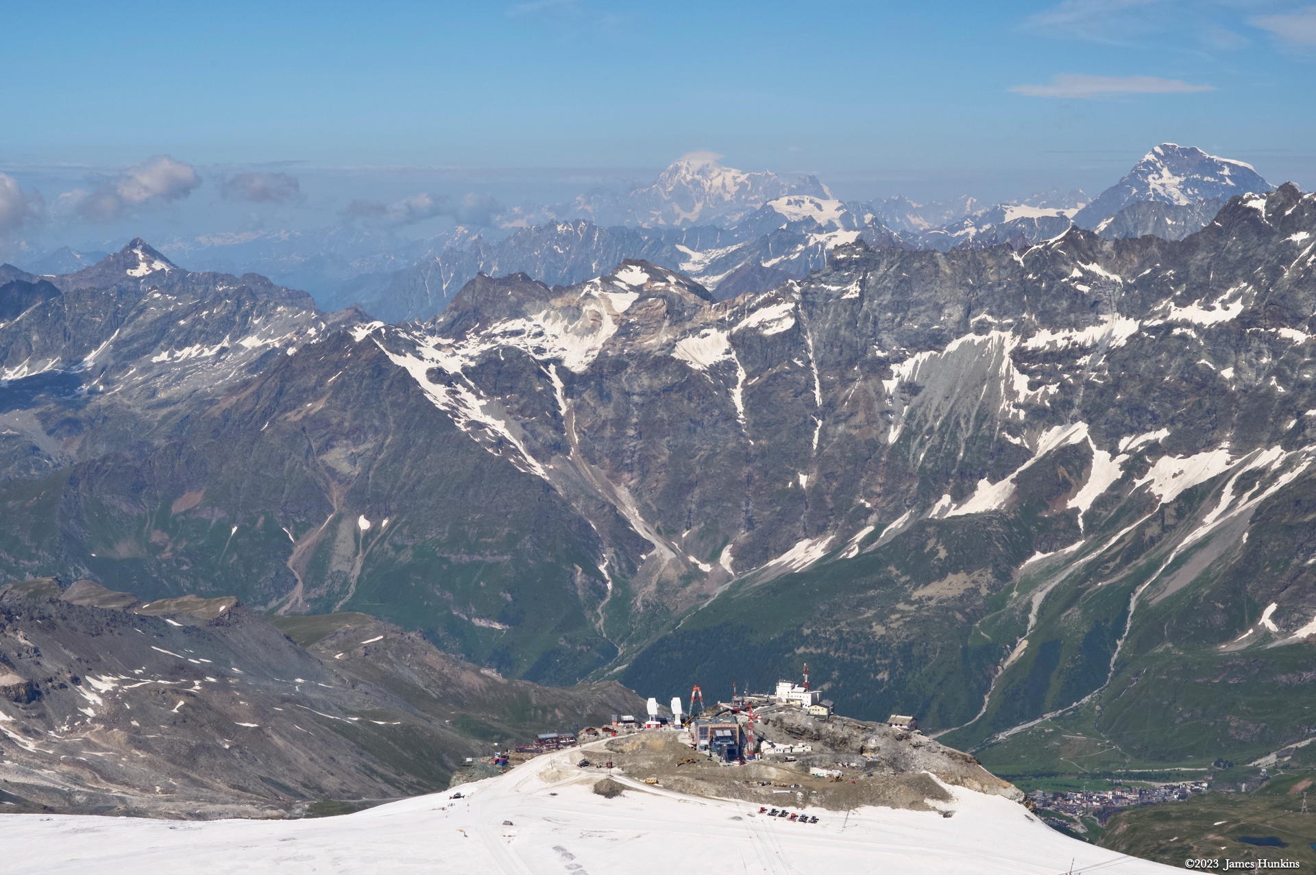
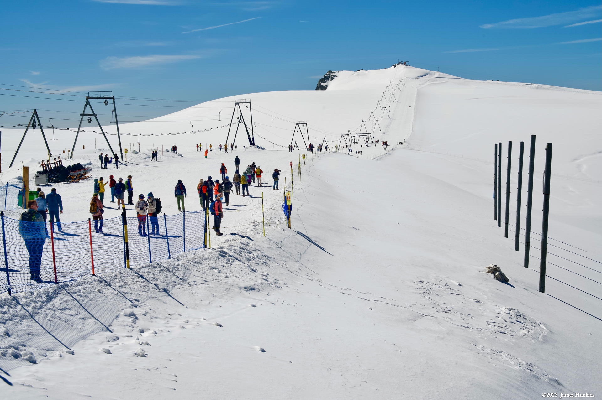
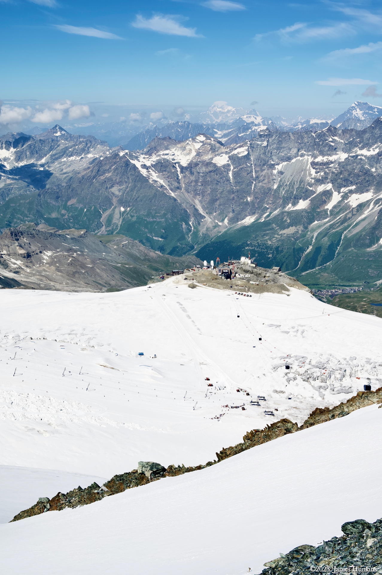
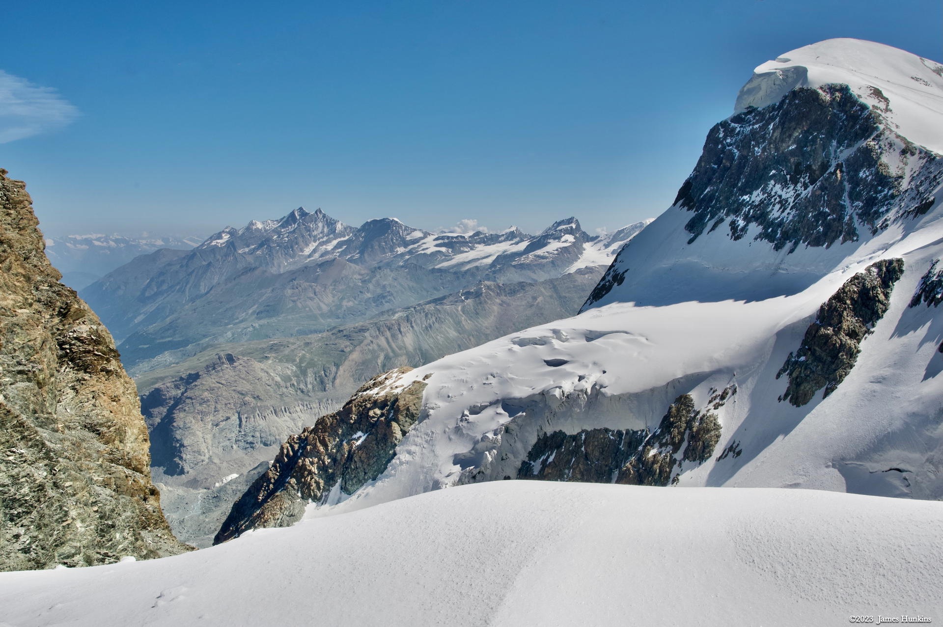
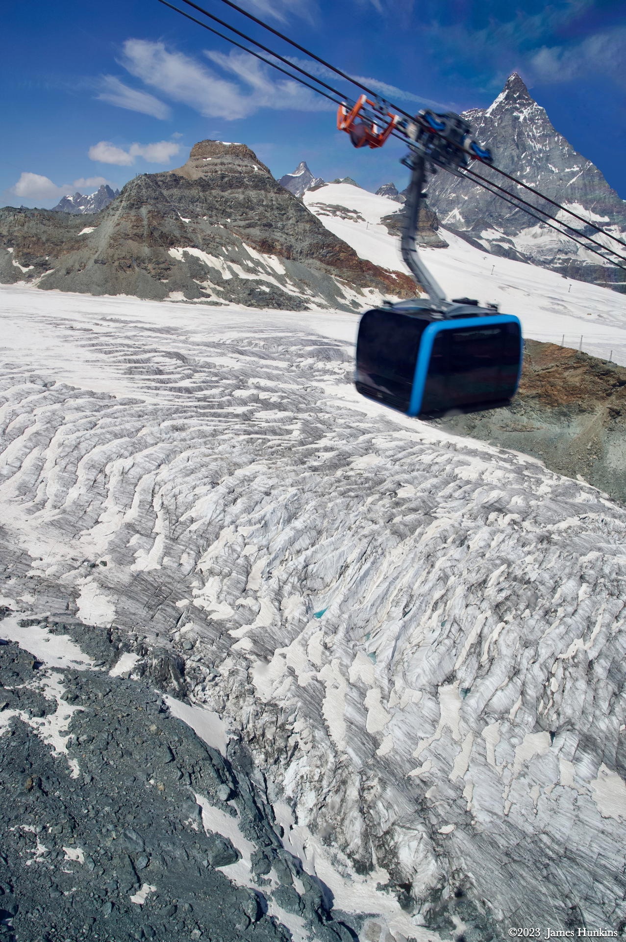
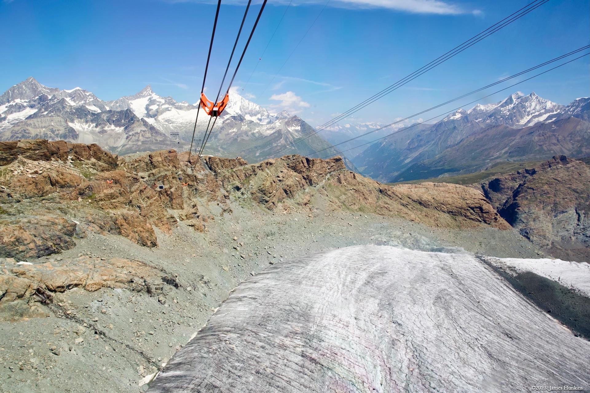
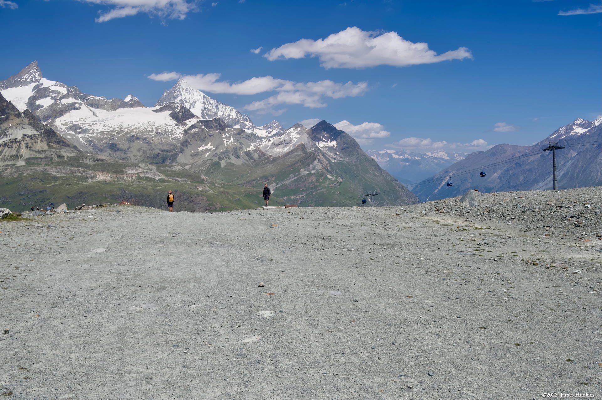
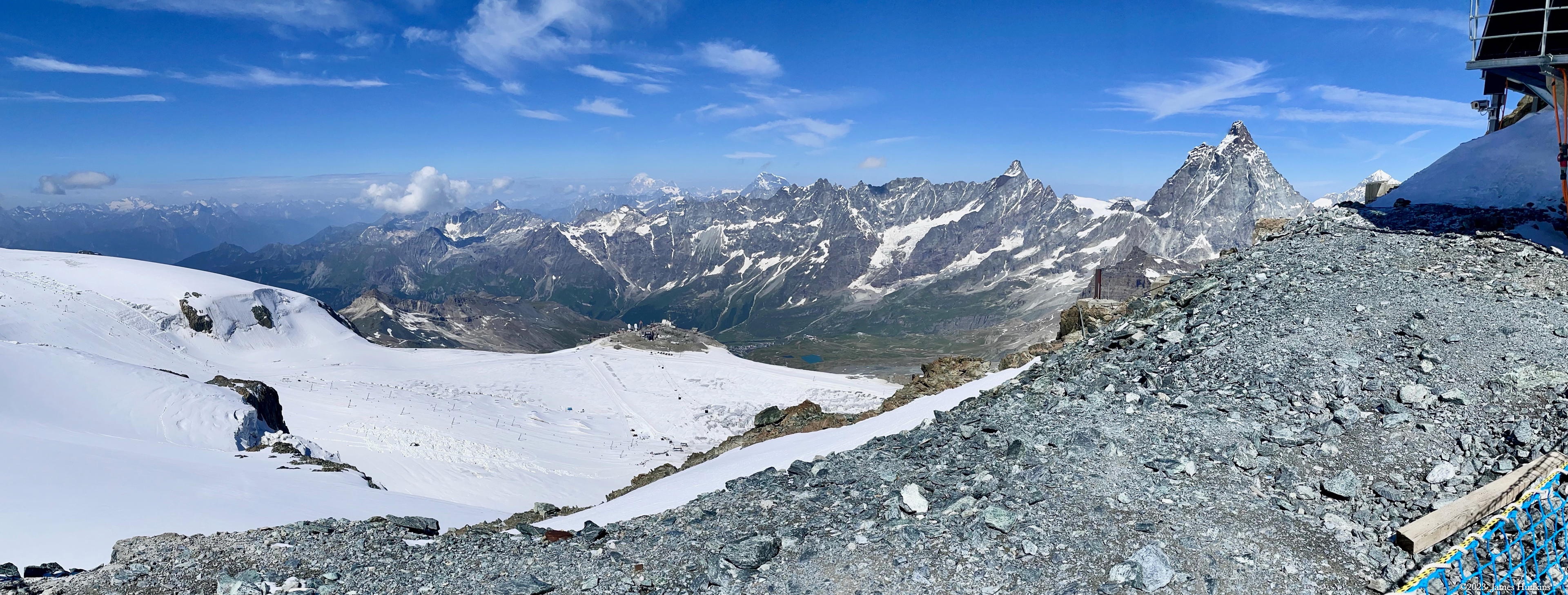
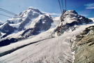
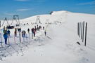
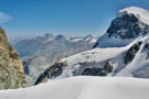
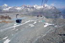
For the final climb, another gondola took us to Klein Matterhorn, riding out over snow fields and glaciers. At the top, it feels like nothing can be higher (except the Matterhorn which is 595 m / 1,953 ft higher than we were). Heading out of the station, one walks onto a snow-packed ridge that is full of skiers and walkers. Further along the ridge, a glacial ski area begins with 21 km of pistes. There are not that many places where one can ski year-round like they do here. You can look down onto the French side to see another station and more of the ski area.
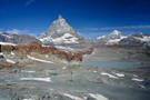
The Matterhorn is famous for its easily recognizable sharp peak. This profile is visible on three sides of the mountain (which we saw all three during the week). But for some reason, from the French side, while still visible as a massive rugged peak, it doesn’t seem to have the same distinctive profile.
I do recall when I visited the area several decades ago that my friend and I did some spring skiing on a glacier. But thinking back, I believe it was a different glacier. To access the slopes, it only had a T-bar run (i.e. no chairlift or gondola - one had to literally ski up the slope with a bar pushing you along). Turns out I don’t do T-bars well and had some ‘interesting’ experiences on the bar during that trip. Luckily, as is tradition in Switzerland, all huts seem to be required to have a bar at the top of major runs. I remember taking advantage of that to help get over some very embarrassing moments 😀.
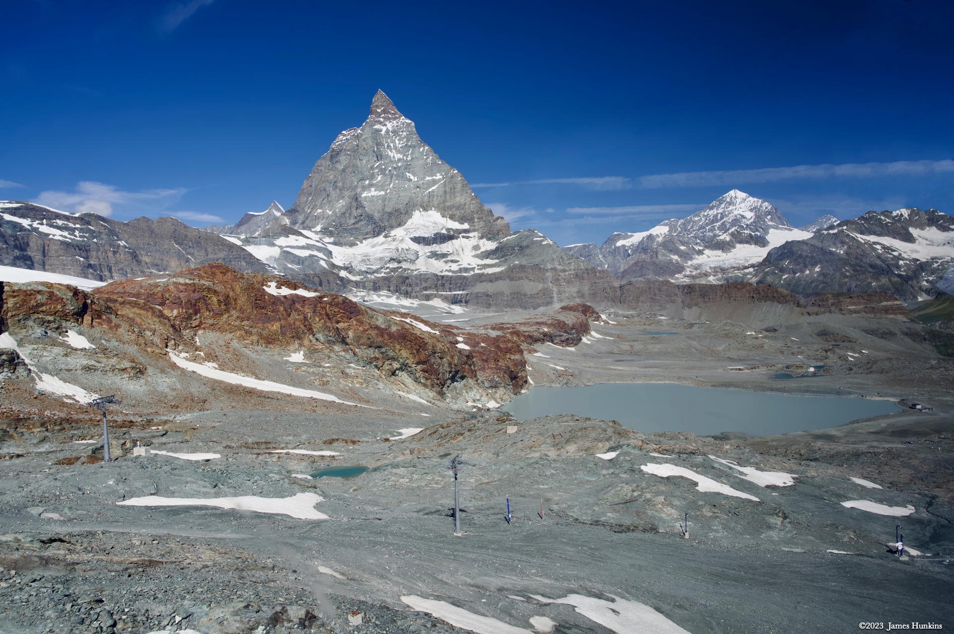
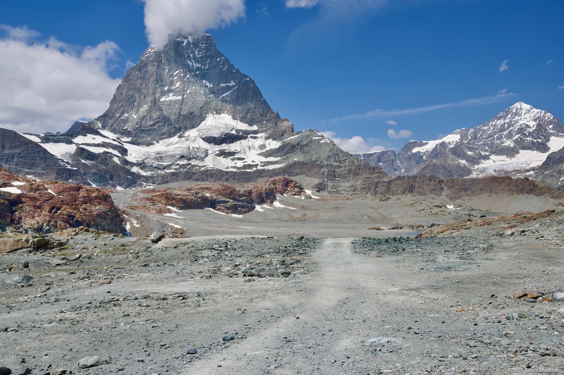
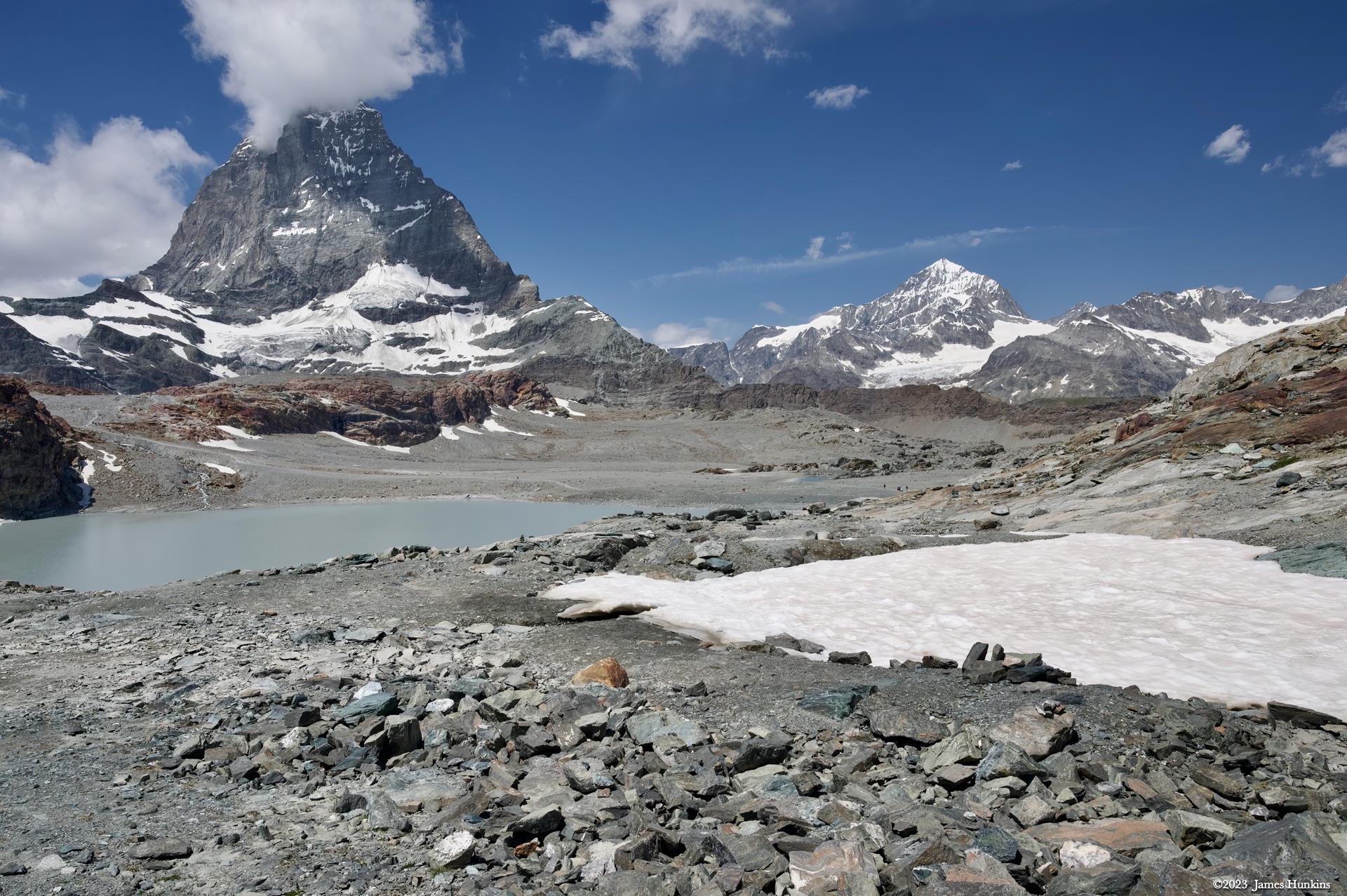
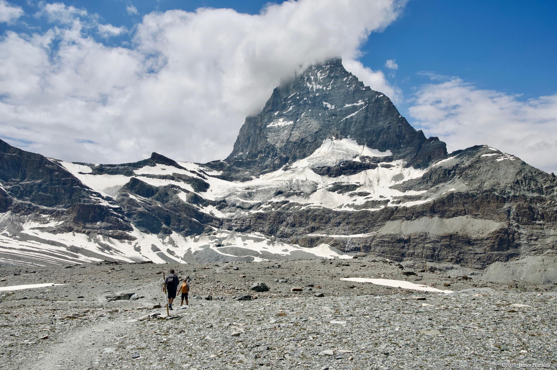
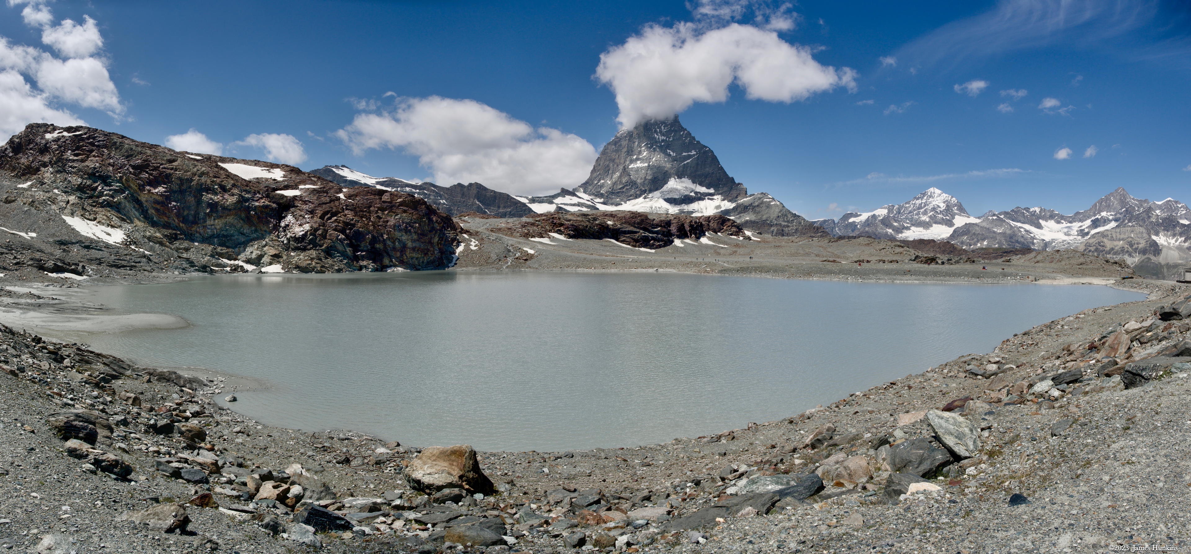
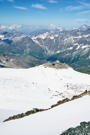
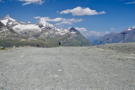
Back to this trip - after looking around on top and stopping for a cup of hot chocolate, we headed back down on the gondola to Trockener Steg where we began our hike down the Glacier Trail. The trail started out across a very barren landscape down to a lake nestled in the basin’s rocks, up over a ridge that was rich in red stone, and then into a large open area below the Matterhorn peak itself. If you look at the photos, the ridge that goes up the right side of the Matterhorn is the primary climbing route. There is even a small hut partway up the climb.
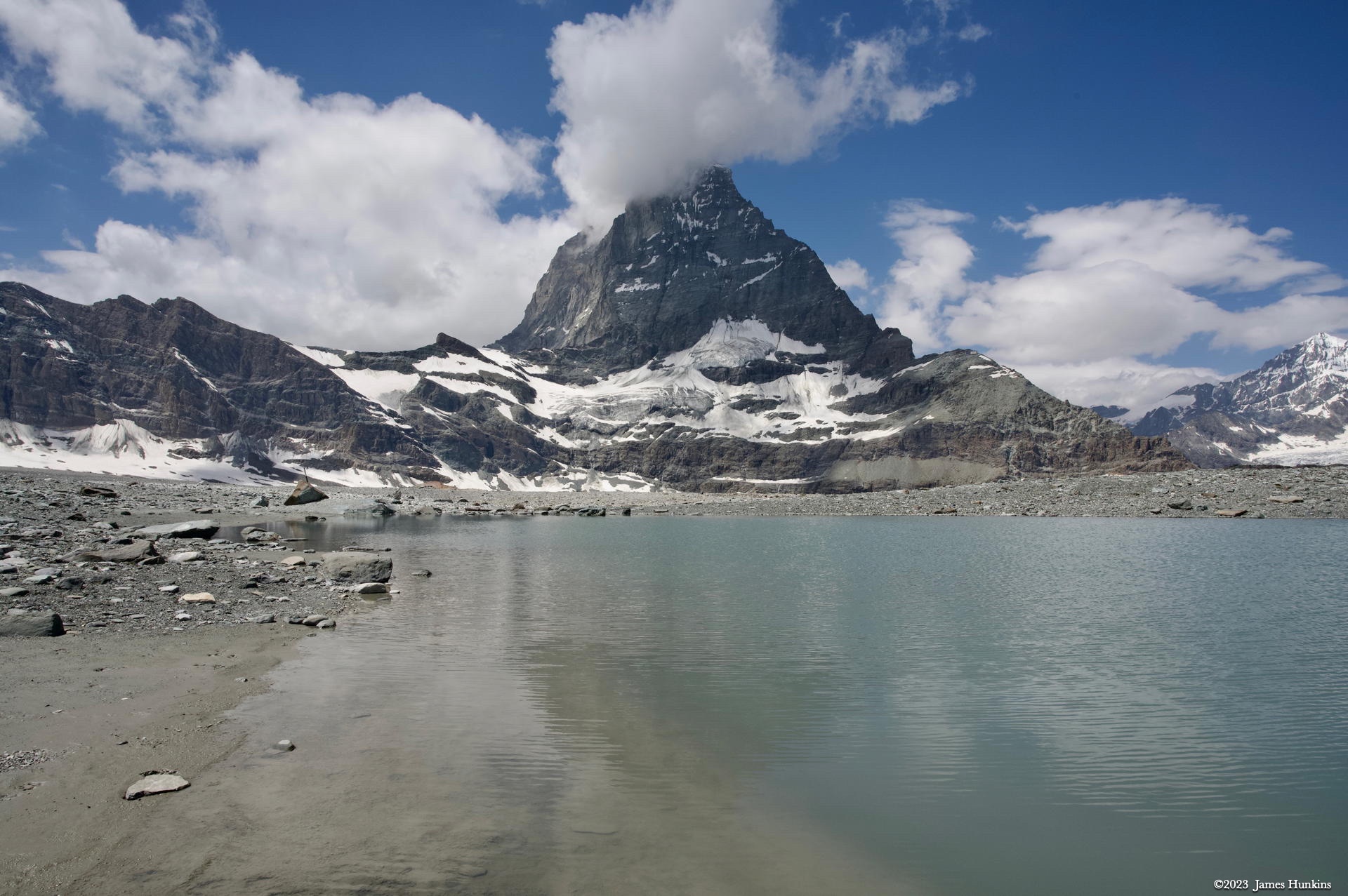
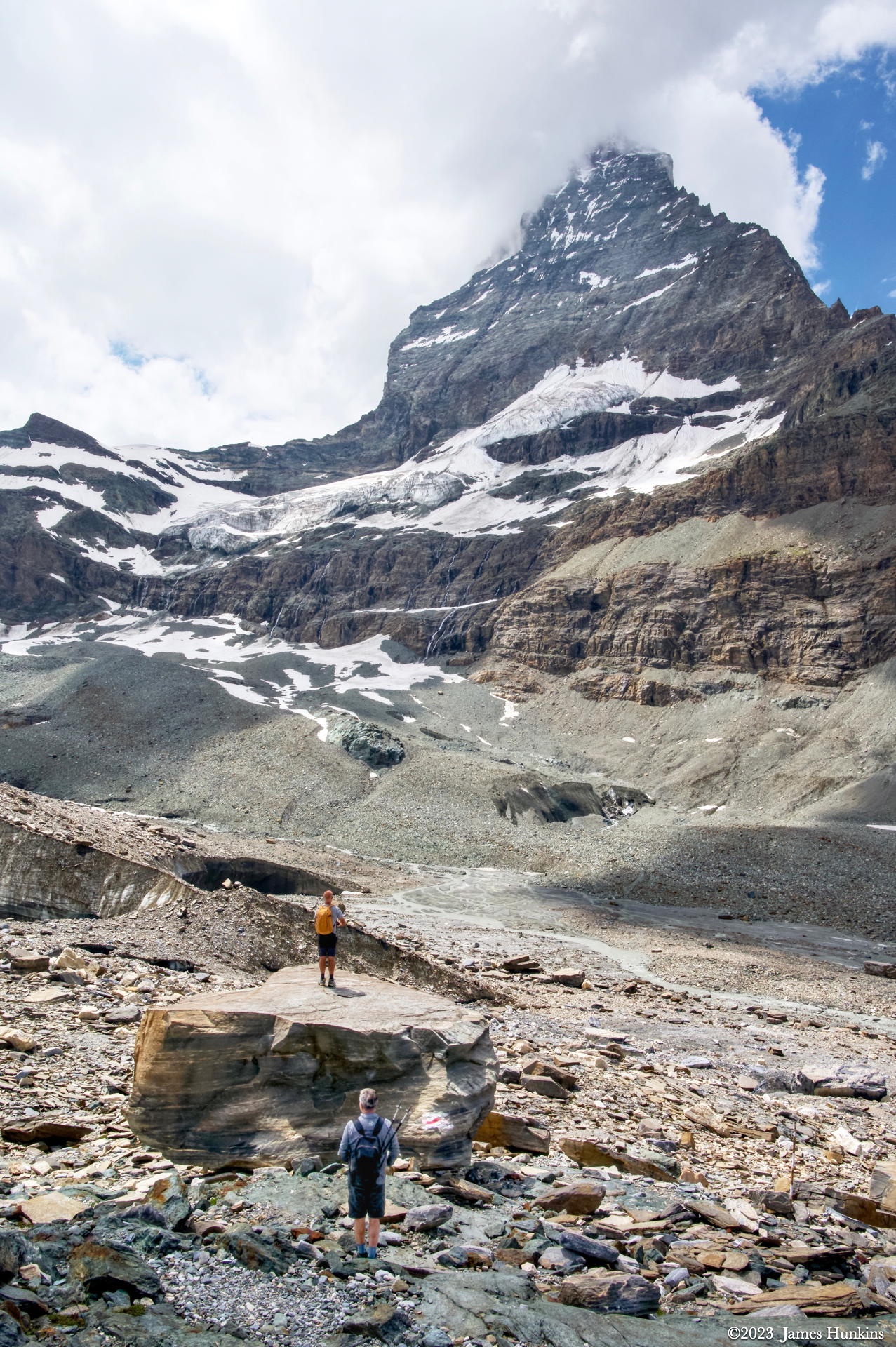
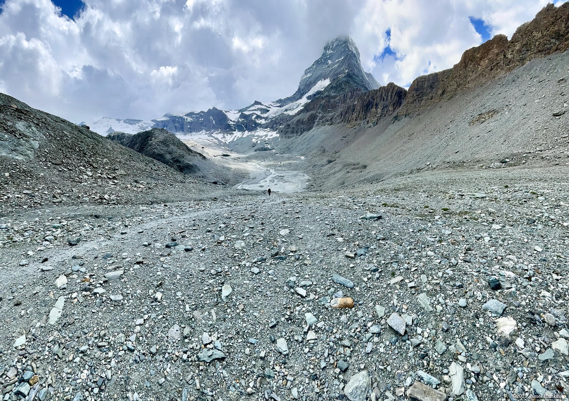
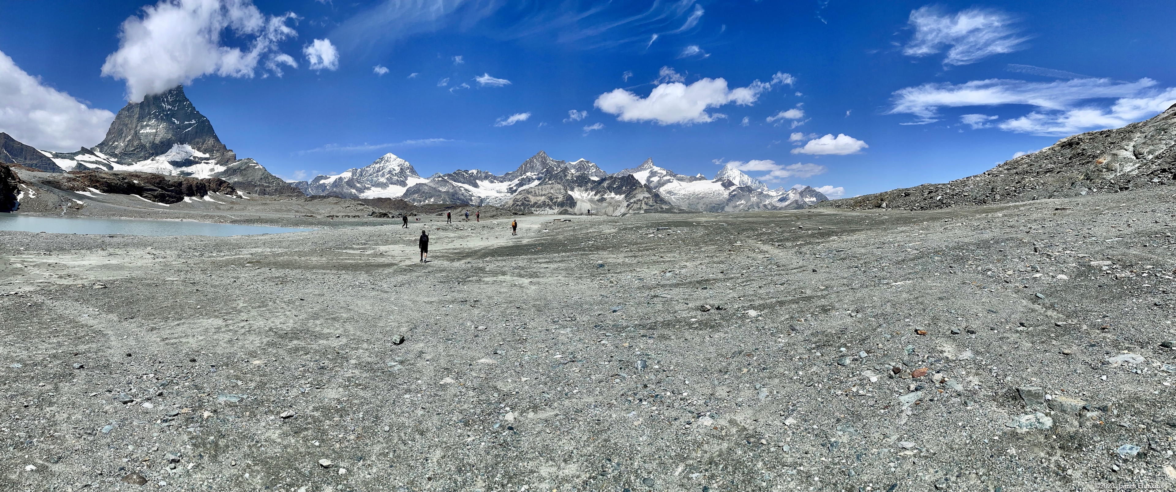
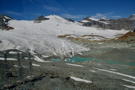
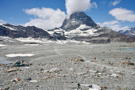
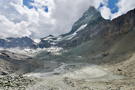
After passing another lake in this last open area, the trail follows along the side of a barren valley with a stream running down from the snow fields above. On the other side of the valley, the end of the glacier peeks out from under piles of rubble and stone, showing patches of ice with water running out from under it all. One of the photos included here shows the Matterhorn on the right side above the water flowing out from under the ice/snow/rock fields. Unfortunately, if you haven’t been there, it is hard to grasp the enormity of it all.
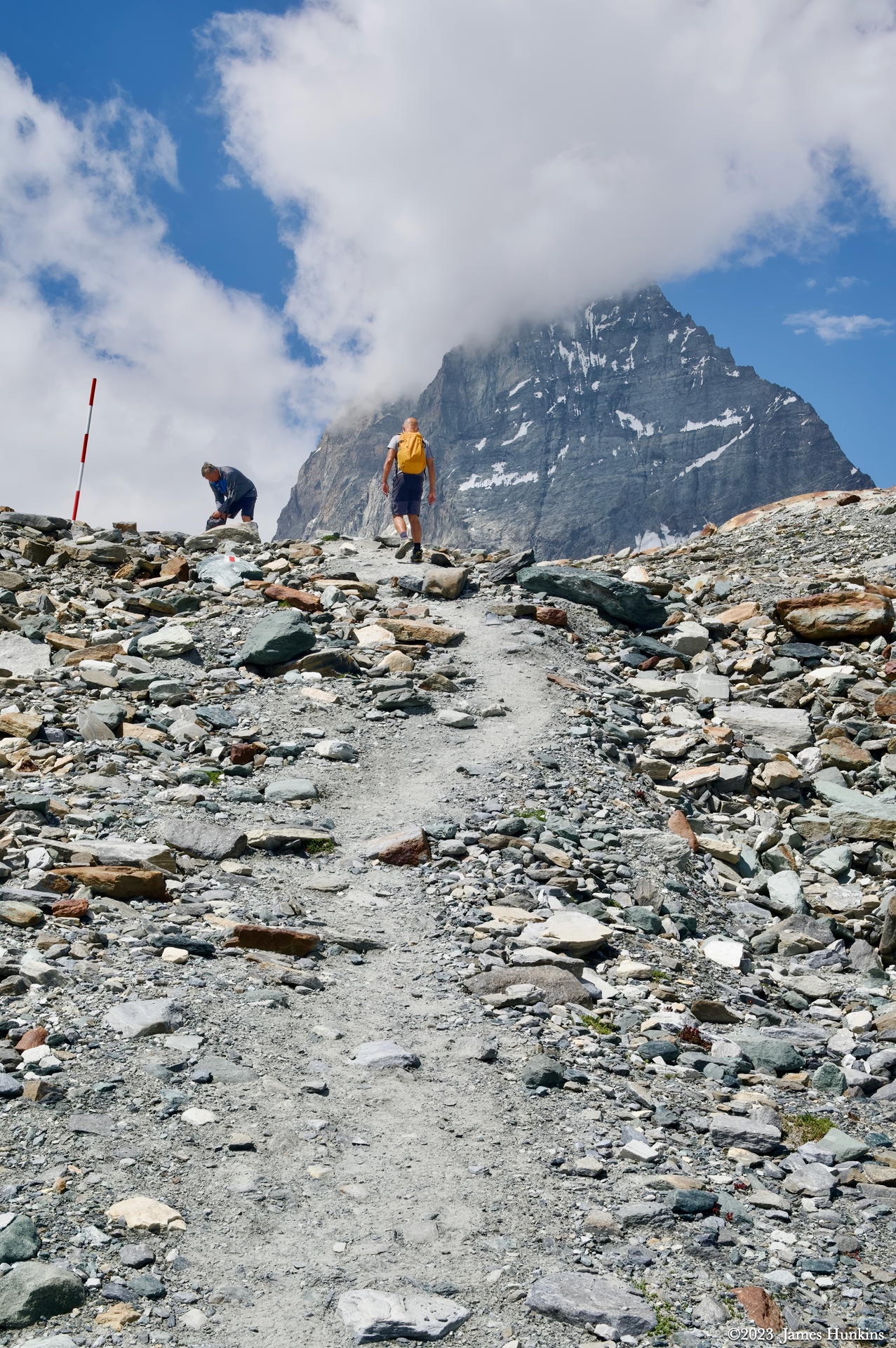
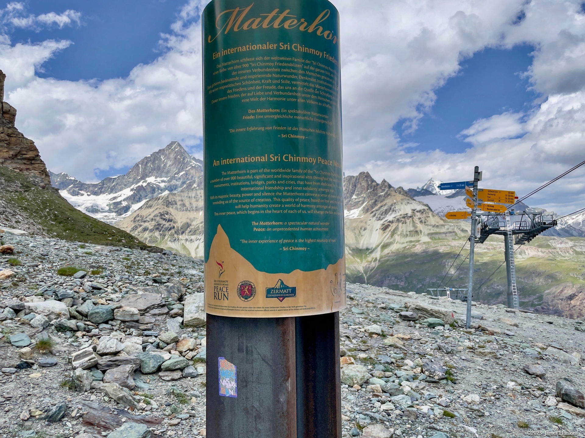
Climbing up above the valley, we crossed a ridge with one of the winter chair lifts at the top (not in operation during the summer). There we found a Sri Chinmoy International Peace-Blossoms post. Sri Chinmoy Kumar Ghose was an Indian spiritual teacher and philosopher. This Matterhorn location is just one of over 800 Sri Chinmoy Peace Markers dedicated to the goal of peace, found in 50 nations around the world. I have included a link in case you are curious.
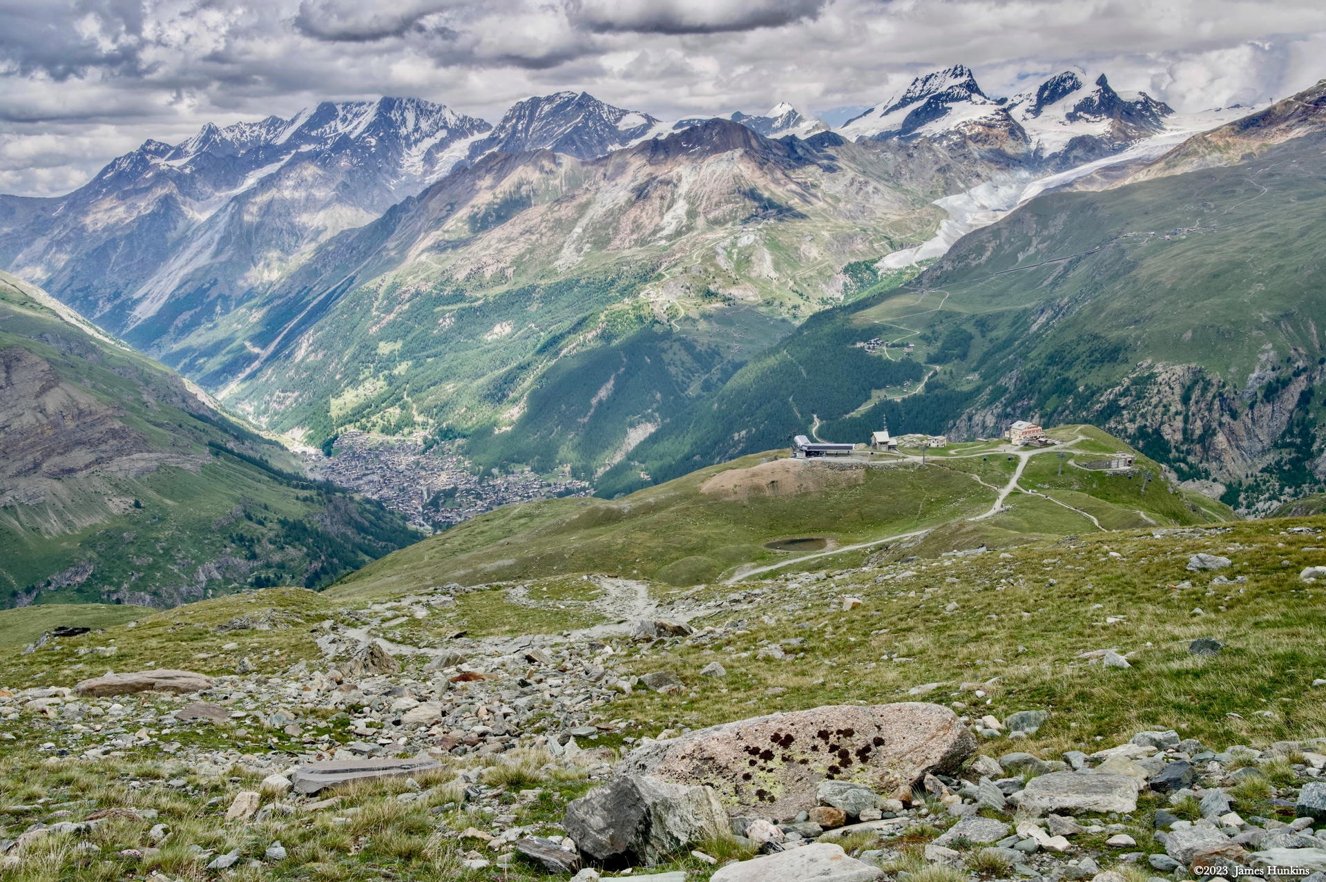
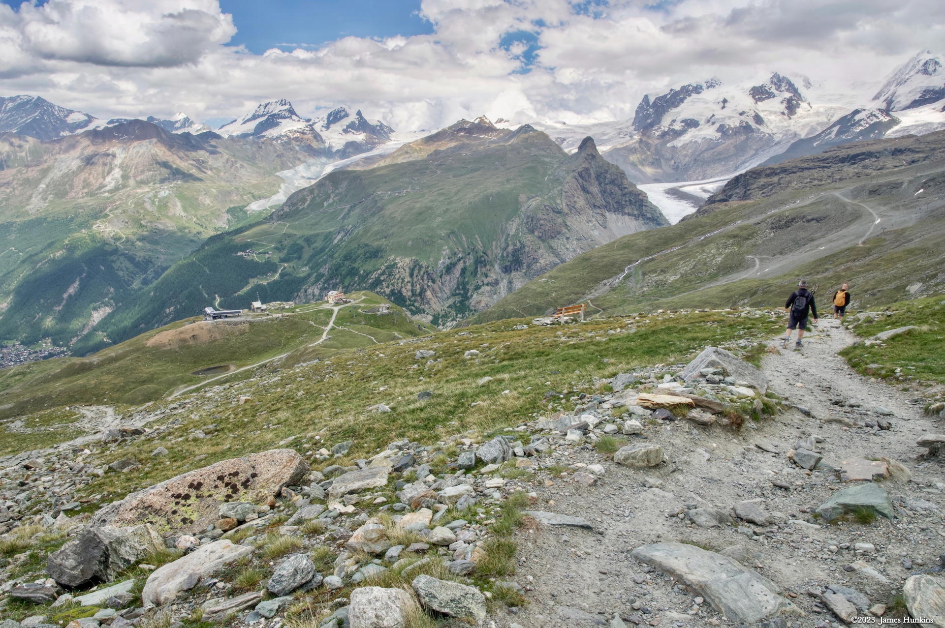
Heading down the other side back towards Zermatt, we were able to see the Schwarzee gondola station way below us. Even further nestled in the bottom of the valley, we could see Zermatt. During this part of the hike, the weather had turned chilly with some scattered showers here and there. Once at the gondola, none of us had any desire to do anything but have a nice ride back to town with a single gondola change back at Furi station.
VIEWING HELP
To close this window, click the X in the upper right hand corner. Or click anywhere outside of this window's area.
Photos from each day are shown in thumbnail (small) form. Panoramas are either wide or tall images, while normal photos are small rectangles. All photos shown in the PHOTO SHOWCASE section can be enlarged for better viewing. Photos will enlarge to fit your browser window width. Therefore, to view them at larger sizes simply make your browser window wider.
If there is any issue or the need to inquire/comment about an image, please refer to the Image ID label (see below) of the specific image along with the trip name found at the top of the browser window.
Video Clips
Depending on the browser, some of the controls may not always be supported.
Most videos will start playing automatically. Sound is automatically off even if included with a video. See D, E below for sound control.
A few small videos are set to loop endlessly, while most just play to the end.
- A: To start or stop a video, click in this area (even if the symbol is not visible)
- B: If a browser shows this symbol, clicking on it will restart the video from the beginning
- C: Progress bar - will display total video time on the right.
- D, E: This seems to have the most variants between browsers. If the video description says 'w/ sound’, you can adjust the volume with this control
If neither is visible, move the cursor to the E area and either E and/or D will be visible
If E is visible but not D, click on E
Once D is visible, slide the bar up or down to adjust the volumn
Panoramas
Clicking anywhere on a panorama thumbnail will cause the image to expand to fill the browser width. Clicking again anywhere in the browser window or scrolling the browser window will cause the expanded image to shrink back to its smaller thumbnail size.
The Image ID and description is found just below the thumbnail image on the left side.
Individual Photographs
If you click on any photo thumbnail, it will open a larger viewer which can be used to walk through all of the standard photos on the page. Once open, to go forward click on the > on the right side of the enlarged image. To scan backwards, click on the < on the left side. To close the larger images either click on the X in the upper right hand corner of the browser window or anywhere outside of the enlarged image.
The Image ID label can be found by hovering a cursor over the thumbnail image (may not be available on some tablets/phones) or, once enlarged, from the lower left hand side just under the image.
Additionally, in the same area as the Image ID (or the upper left corner for newer/updated sites) a count showing the current image number versus the total number of images available for viewing.

For newer or updated sites (look for the orange checkbox in the header of a sites main page), additional buttons have been added when viewing a full size image. From left to right, the buttons are:
- Email: will open an email with information and a link to the current image
- WhatsApp: if WhatsApp is on your system, will open a browser window to open WhatsApp and create a message with information and a link to the current image
- FaceBook: Will open a browser window to open Facebook and create a message with information and a link to the current image
- full screen: will take over the entire display versus just the browser in most systems; ESC returns to the brower only mode
- magnify: enlarges the image within the browser or full screen; if the image is larger than can be displayed it can be scrolled
- exit: will close the large image viewer returning to the thumbnails


Links:
PHOTO SHOWCASE
- click on any panoramic image for a larger view
- click on any thumbnail image for a larger view/slideshow
-
 2307070001NApproaching Trockener Steg Station by gondola
 -
 2307070003NApproaching Trockener Steg Station by gondola
 -
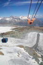
 2307070004NHeading up to Klein Matterhorn by gondola
 -
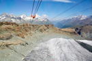
 2307070006NHeading up to Klein Matterhorn by gondola
 -
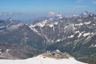
 2307070023PArrive at Klein Matterhorn, our highest point of the trip
 -
 2307070007NLooking into France from Klein Matterhorn
 -
 2307070010NRidge from Klein Matterhorn heading to glacial skiing
 -
 2307070011NAnother view from Klein Matterhorn into France showing ski areas
 -
 2307070014NAnother view from Klein Matterhorn
 -
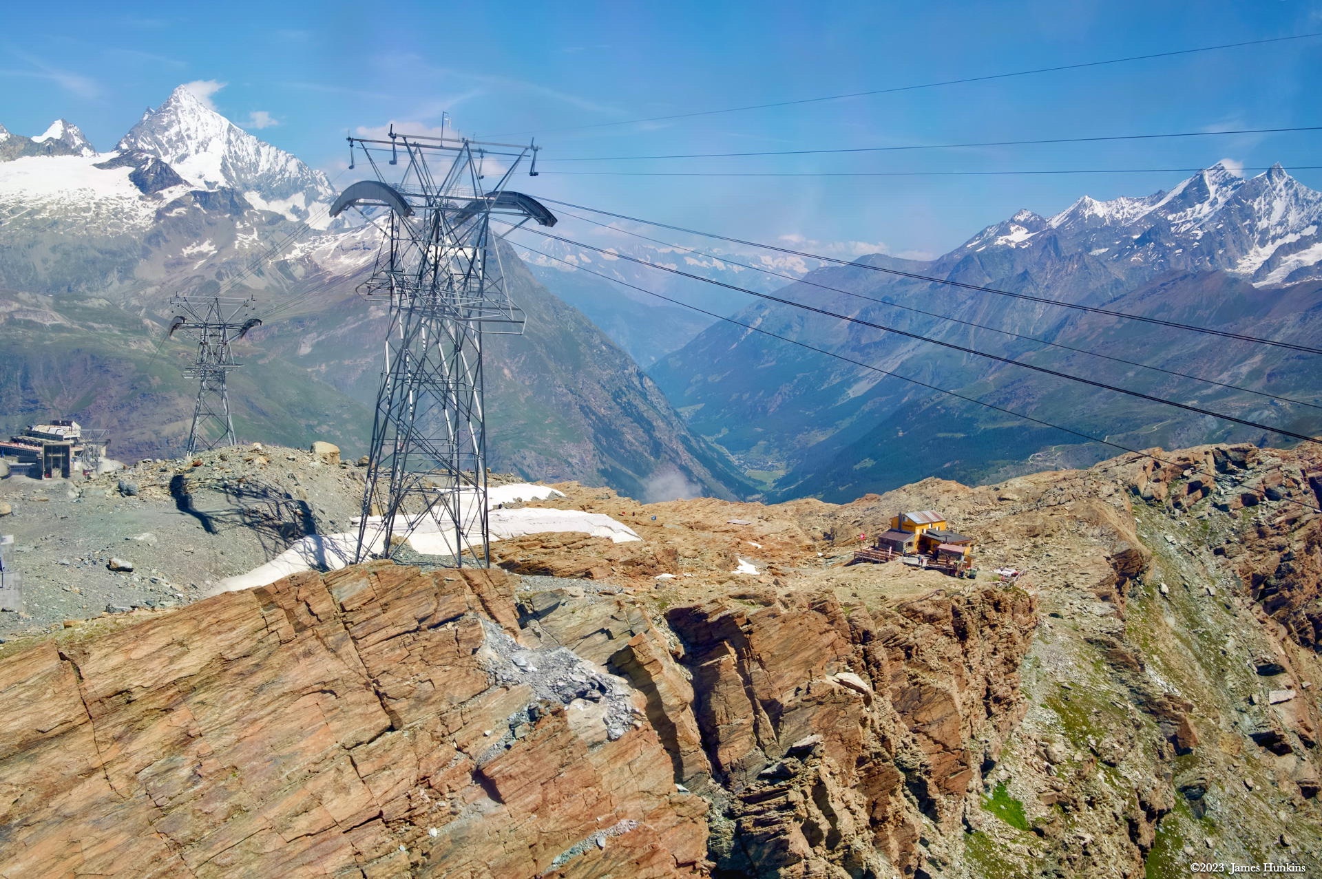
 2307070017NHeading back down from Klein Matterhorn
 -
 2307070018NLooking back at the Matterhorn from the gondola
 -
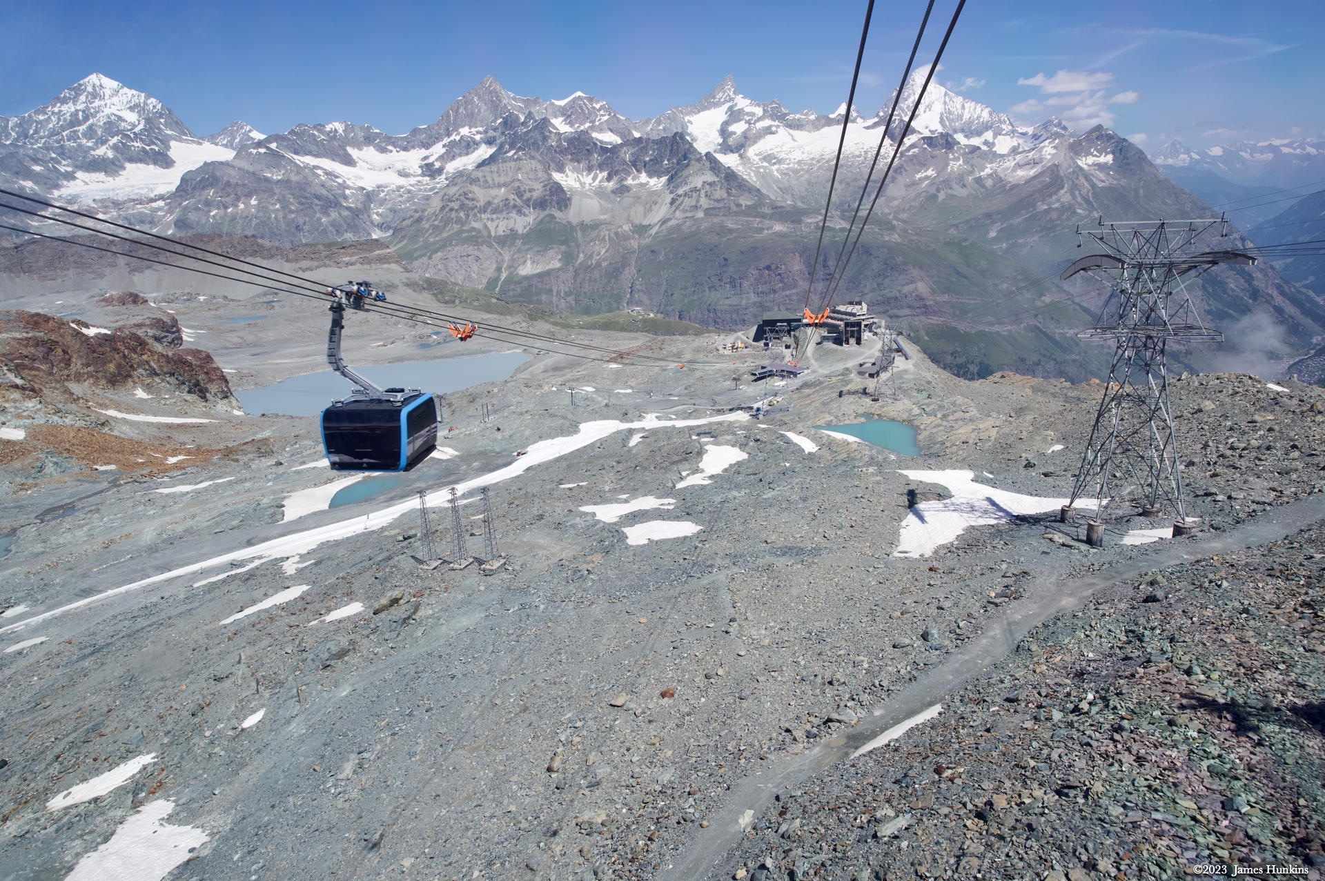
 2307070019NHeading back down from Klein Matterhorn
 -
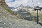
 2307070021NSeveral ski ‘huts’ below Klein Matterhorn
 -
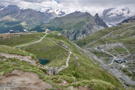
 2307070022NApproaching Trockener Steg from above
 -
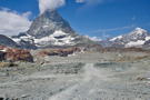
 2307070035NThe Glacier Trail starting at Trockener Steg
 -
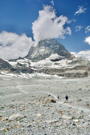
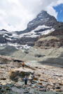
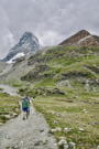
 2307070024NThe Glacier Trail heads towards the Matterhorn right away
 -
 2307070025NThe trail approaches a small lake under the Matterhorn
 -
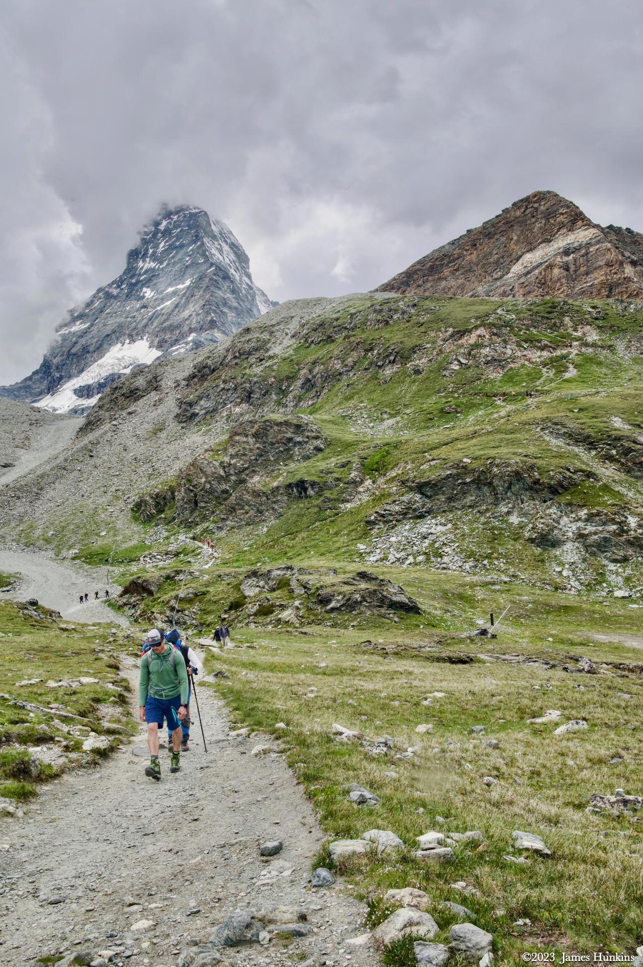
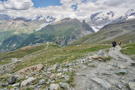
 2307070037NOur group takes the trail over a ridge below the cloud shrouded Matterhorn
 -
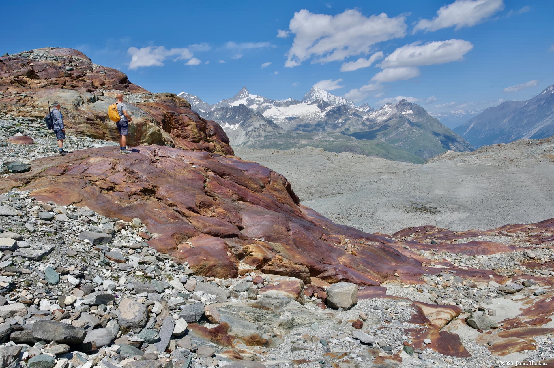
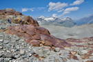 2307070038NClimbing above the first lake, the stone formation is a rich red coloration
 -
 2307070039NBack off the red stones, the trail continues towards the Matterhorn
 -
 2307070040NThe Glacier Trail continues towards the Matterhorn
 -
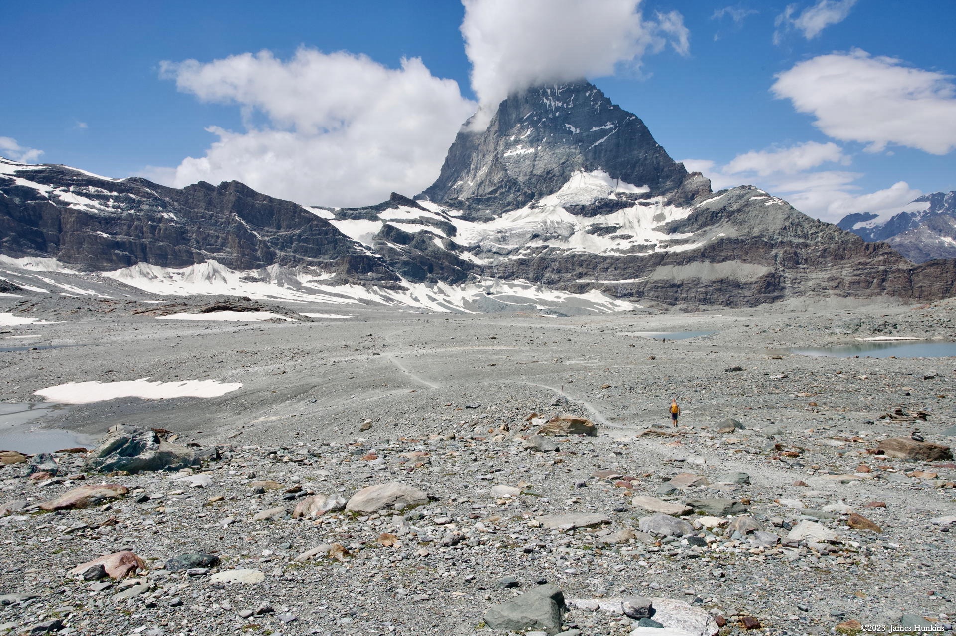
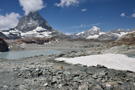
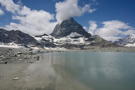 2307070042NA lake in the basin below the Matterhorn
 -
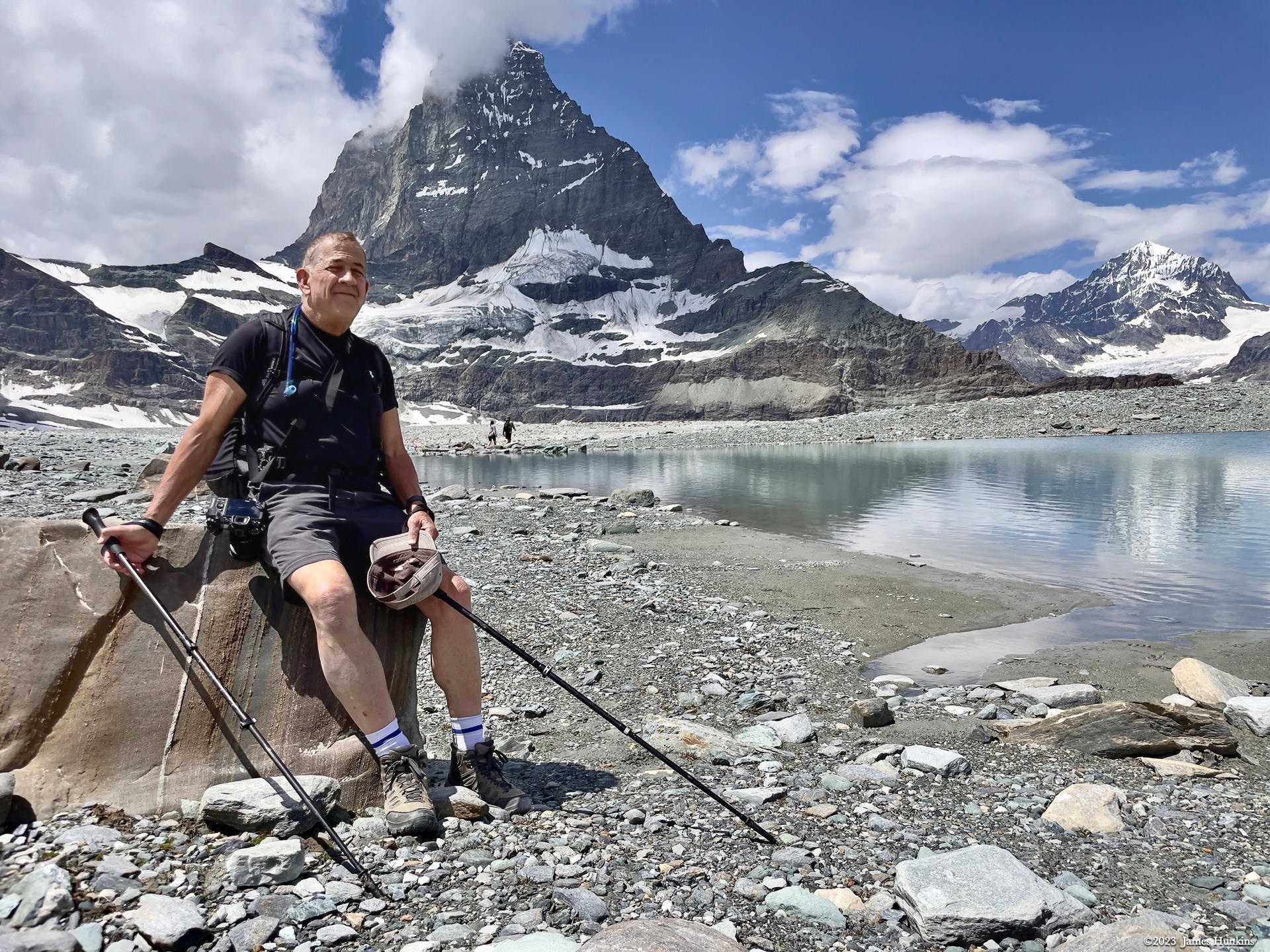
 2307070049PSorry again - somehow another shot of the photographer (me) got into the mix here
 -
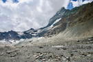
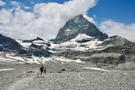 2307070044NOnce pass the lake, the trail starts dropping into a valley below the Matterhorn
 -
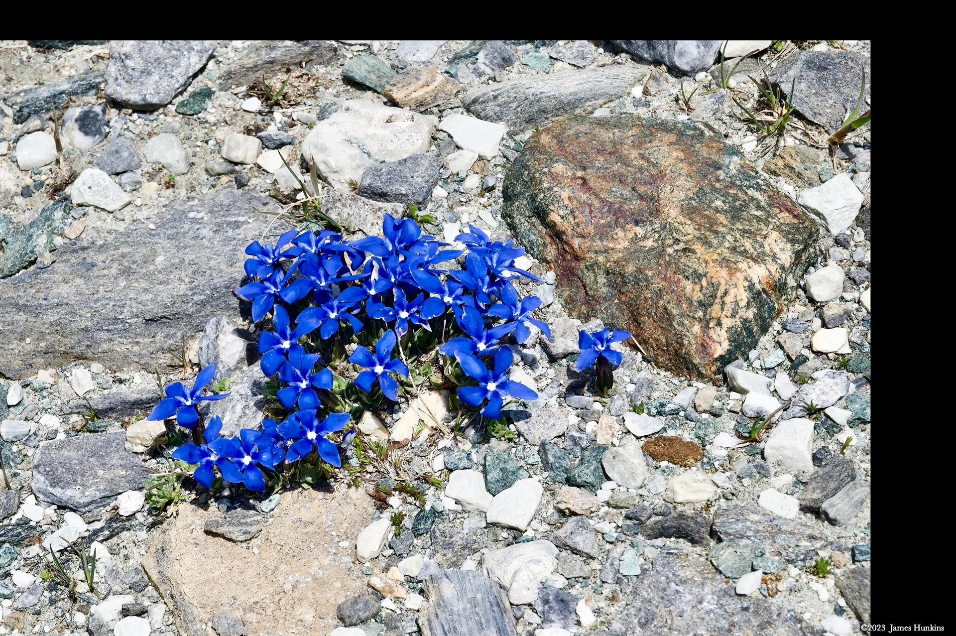
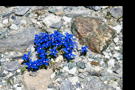 2307070047NEven here with practically nothing but stone and water, small mountain flowers have established footholds
 -
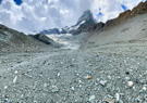
 2307070048NLooking back at the valley we had just come through; the gravel/stone on the other side covers glacial snow
 -
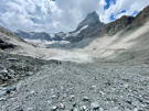
 2307070051NFrom the valley floor just before we started climbing out of it
 -
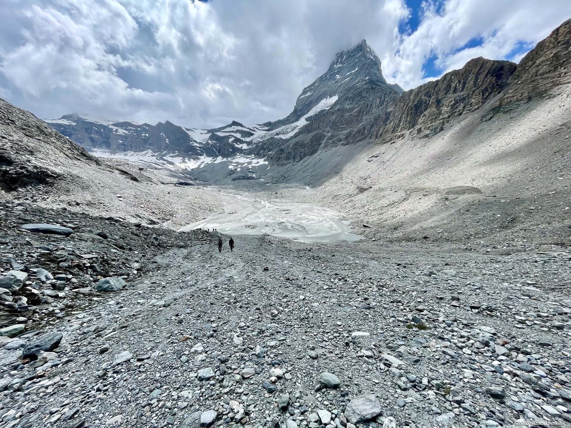
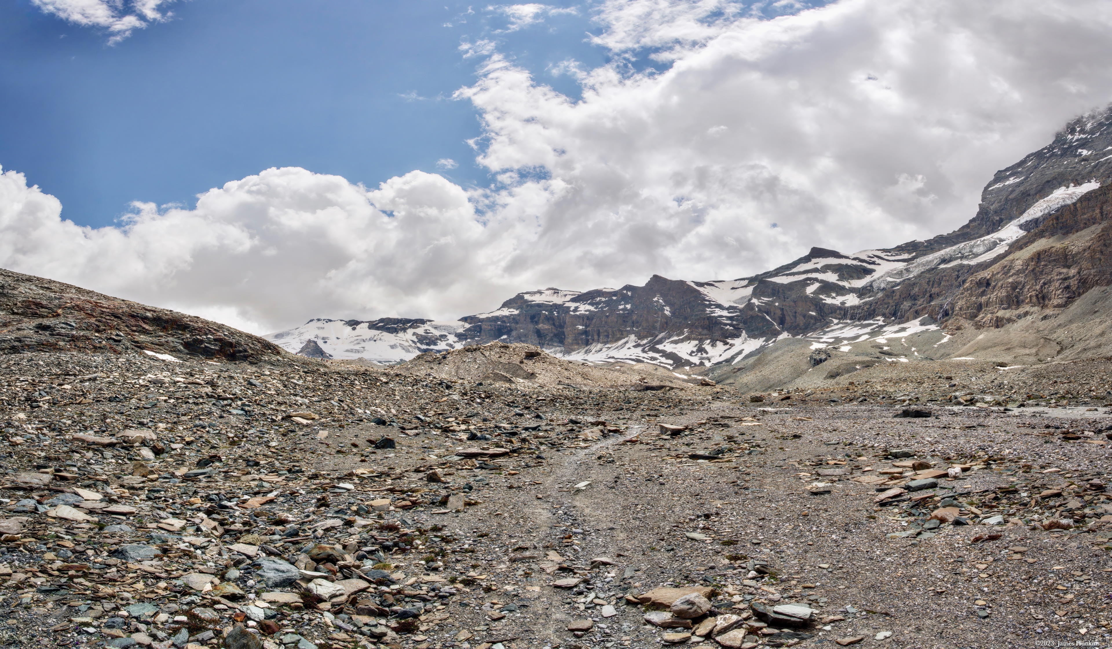
 2307070058NLooking back up the valley we had been in, the silt and water from the glacial melt is clear
 -
 2307070066PThe climb continues up from the valley
 -
 2307070067PThe climb continues up from the valley
 -
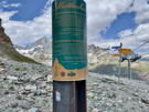 2307070068POn the ridge top, we found a Sri Chinmoy Peace Marker next to an out-of-season chairlift
 -
 2307070059NLooking down the other side of the ridge
 -
 2307070061NWe can see the Schwarzee station below us with Zermatt down in the valley
 -
 2307070062NWe can see the Schwarzee station below us with Zermatt down in the valley
 -
 2307070064NStart of a very, very steep descent for our trail; Schwarzee station on the left
 -
 2307070063NIt does pay to look back at where one came from now and then